We all know how much our cities lack nature parks and open spaces compared to other countries. The Pasig River Esplanade is one of the few areas in Manila where people can safely go on leisure strolls and sightseeing for free. As of April 2026, a nearly 2-kilometer stretch of the area connecting Fort Santiago in Intramuros to Arroceros Forest Park near the LRT-1 Central Terminal station has been opened to the public.
This existing linear park is just the first segment of a planned 25-kilometer riverside promenade traversing the cities of Manila, Mandaluyong, Makati, Pasig, and Taguig, following the whole stretch of the Pasig River. The riverside walkway draws inspiration from similar linear parks like the Iloilo Esplanade and waterside projects in the Philippines and Singapore.
In case you’ve never visited the area, here’s all you need to know about the esplanade’s various phases, how to get there by public transport, where to park nearby, and more.
What is the Pasig River Esplanade?
The Pasig River Esplanade is a multi-phase urban renewal project that aims to transform the riverbanks into a vibrant, walkable, and sustainable urban park. The initiative also aims to improve transportation connectivity in Metro Manila and adjacent provinces.
According to the Office of the Presidential Adviser on Pasig River Rehabilitation, since its launch, the initiative has unified government and private-sector efforts to restore the river’s ecological balance and transform it into a sustainable urban corridor.
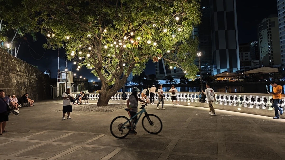
The entire stretch has become a popular spot for strolling, sightseeing, and food trips among locals and tourists, especially during weekends.
This walkway has given people a reason to revisit the area, appreciate historically significant areas along the riverbanks and enhanced the cultural vibrancy within the Pasig River. Heritage advocates and tour organizers now regularly hold walking tours and bike tours around the area, as you can easily walk from Intramuros to Binondo and Escolta through this esplanade.
What are the phases and landmarks along the Pasig River Esplanade?
Phase 1
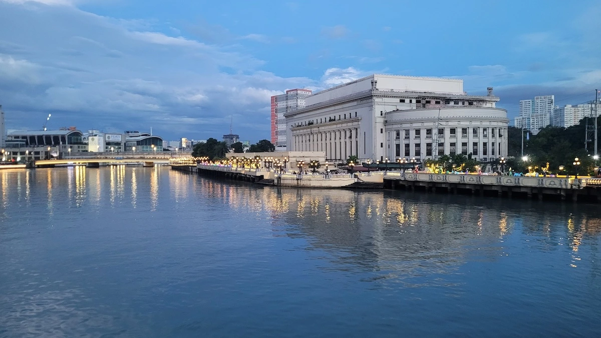
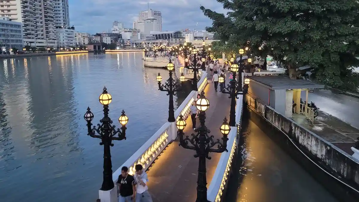
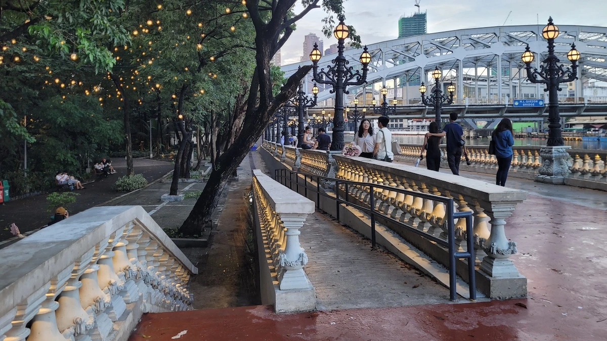
The first phase, which opened to the public in January 2024, is located behind the Manila Central Post Office building near Jones Bridge. This 500-meter stretch serves as the main “showcase area.”
The surrounding structures, including water fountains accented by lighting and lamp posts were designed in the Neo-Classical style to blend with the rehabilitated Jones Bridge and the Central Post Office building. This section contains pedestrian-friendly walkways and benches for visitors to sit and relax. From here, crossing Jones Bridge leads to Escolta and Binondo.
Phase 2
The second phase, which was launched in June 2024, connects the showcase area behind the Manila Central Post Office to Intramuros. Along this 250-meter stretch, you can find multiple mixed-use establishments along the riverbanks and a public pay restroom. This segment currently contains the area with food stalls, shops, and small businesses, catering to students, couples, tourists, and families. The area is lively on weekends and evenings, with buskers, street photographers, games, photobooths, and vendors setting up shop here.
From here, you can walk to the Aduana Building, the Bureau of Immigration, the ruins of the Bastión de Maestranza and Puerta de Almacenes on the west.
Phase 3
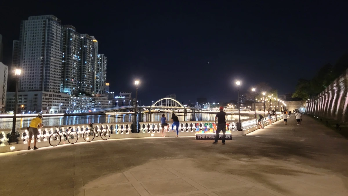
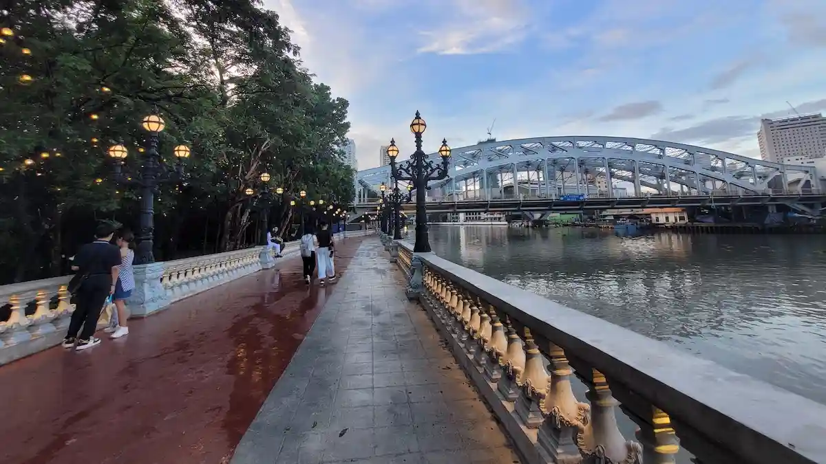
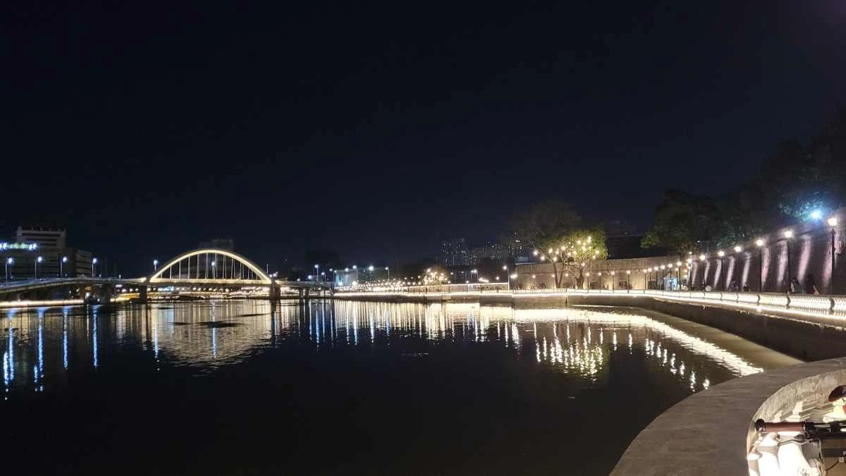
The third phase, which opened to the public on February 2025, is the area from Plaza Mexico (a historic riverside square located at the west end of Magallanes Drive and Riverside Drive) to Fort Santiago. This 600-meter stretch known as The West Showcase Area, includes the beautified Maestranza Esplanade and the rehabilitated 305-meter Fort Santiago Riverwalk, which was formerly only accessible to visitors coming from inside Fort Santiago.
Some areas here have been imporved, with park benches for visitors and more greenery.
Newly built kiosks were added in January 2026 to support micro, small, and medium enterprises and provide safer and more organized spaces for vendors.
Phase 4
The fourth phase, which opened in October 2025, connects the main showcase area to Arroceros Forest Park. This 530-meter segment is located near cultural landmarks like the Metropolitan Theater and the Manila City Hall. It’s also located near the LRT-1 Central Station Terminal and the MMDA Lawton Ferry Station, which provides vital transport links for commuters to access the riverside esplanade network going to Intramuros.
What’s the best time to visit the Pasig River Esplanade?
Currently, with the four existing phases, there’s a 1.7 km long stretch where people can stroll, jog, bike, and enjoy the riverside free from motorized vehicles.
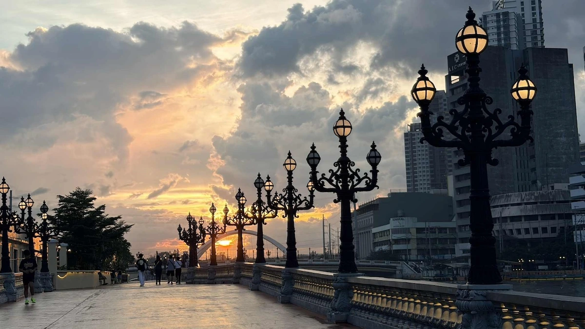
While the esplanade is generally accessible daily for morning walks and exercise, the commercial areas and food kiosks only operate from 3:00pm to 12:00am, making the area ideal for afternoon to evening hangouts. If you want to beat the heat, the best time to go is around 4-5 pm for sunset views and evenings for the light features, though the area can understandably be more crowded at that time.
Future and planned segments
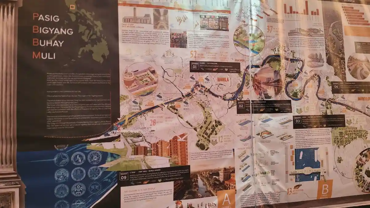
As mentioned, the existing esplanade is only the pilot area covering Manila’s Old Downtown area, and the first of many other segments along the planned 25-km stretch.?
According to the collaborative masterplan design by WTA Architecture and Design Studio released in 2024, the 25-km stretch will consist of nine segments with various activities planned by area. The segments include the Port Area/Manila Harbor, Downtown Makati, Grand Central Makati, all the way to an NCR Frontier in Rizal.
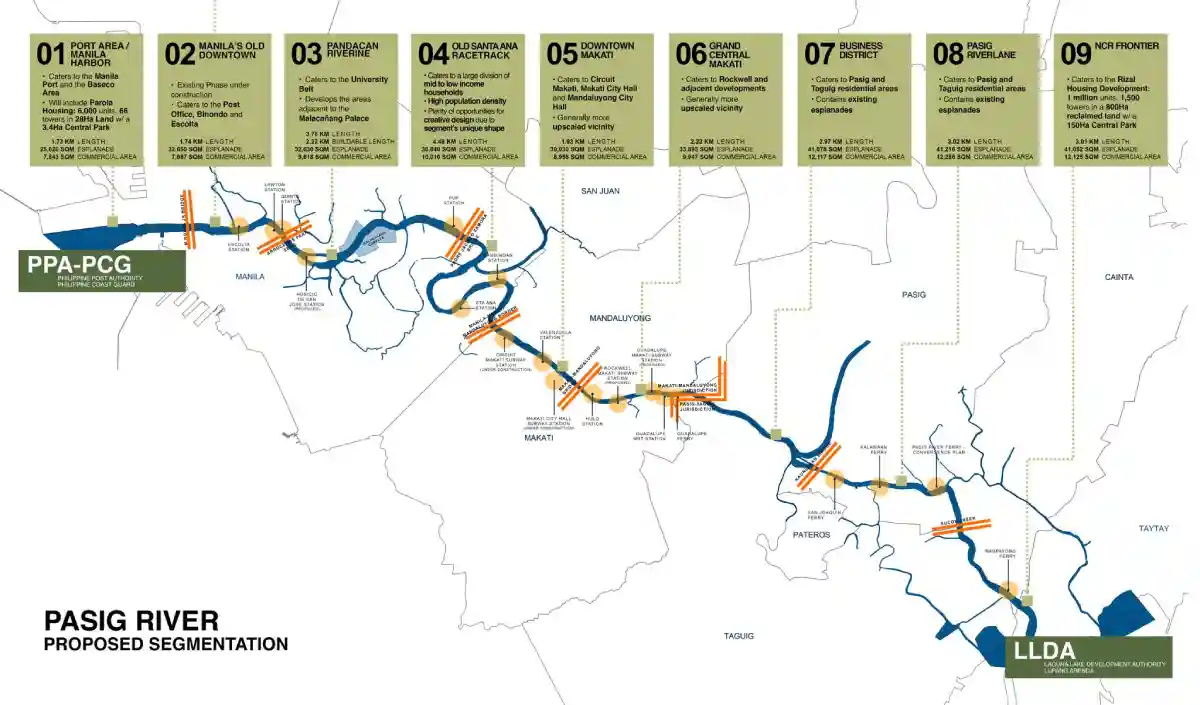
Based on the proposed segmentation, each section will vary in length and have a mix of commercial areas. The whole esplanade is envisioned to have walkways, spaces for bikes, parks, and connections to other transport links.?
- Port Area / Manila Harbor - 1.73 km
- Manila’s Old Downtown - 1.74 km
- Pandacan Riverine - 3.78 km
- Old Santa Ana Racetrack - 4.48 km
- Downtown Makati - 1.93 km
- Grand Central Makati - 2.22 km
- Business District - 2.97 km
- Pasig River Lane - 3.02 km
- NCR Frontier - 3.01 km
How do you get to the Pasig River Esplanade by public transport?
For those traveling by public transport, the easiest way to get to the Pasig River Esplanade is through Central Station on the LRT-1 line, which will bring you directly to Phase 4 through Arroceros Forest Park. If you get off at Carriedo Station, jeeps can take you to Plaza Roma, which is within walking distance of Plaza Mexico.
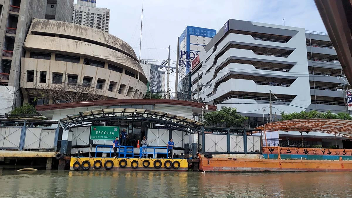
If you're taking the Pasig River Ferry Service, stations near the walkable area of the esplanade include Escolta Ferry Station, Lawton Ferry Station, and Quinta Ferry Station.
Where to park near the Pasig River Esplanade
For those taking private vehicles, street parking is available at Mestranza Parking (near Jollibee), Magallanes Drive (in front of the Chamber of Commerce of the Philippines), and at the back and side of the Manila Post Office. Parking slots are only available on a first-come, first-served basis for cars and motorcycles.
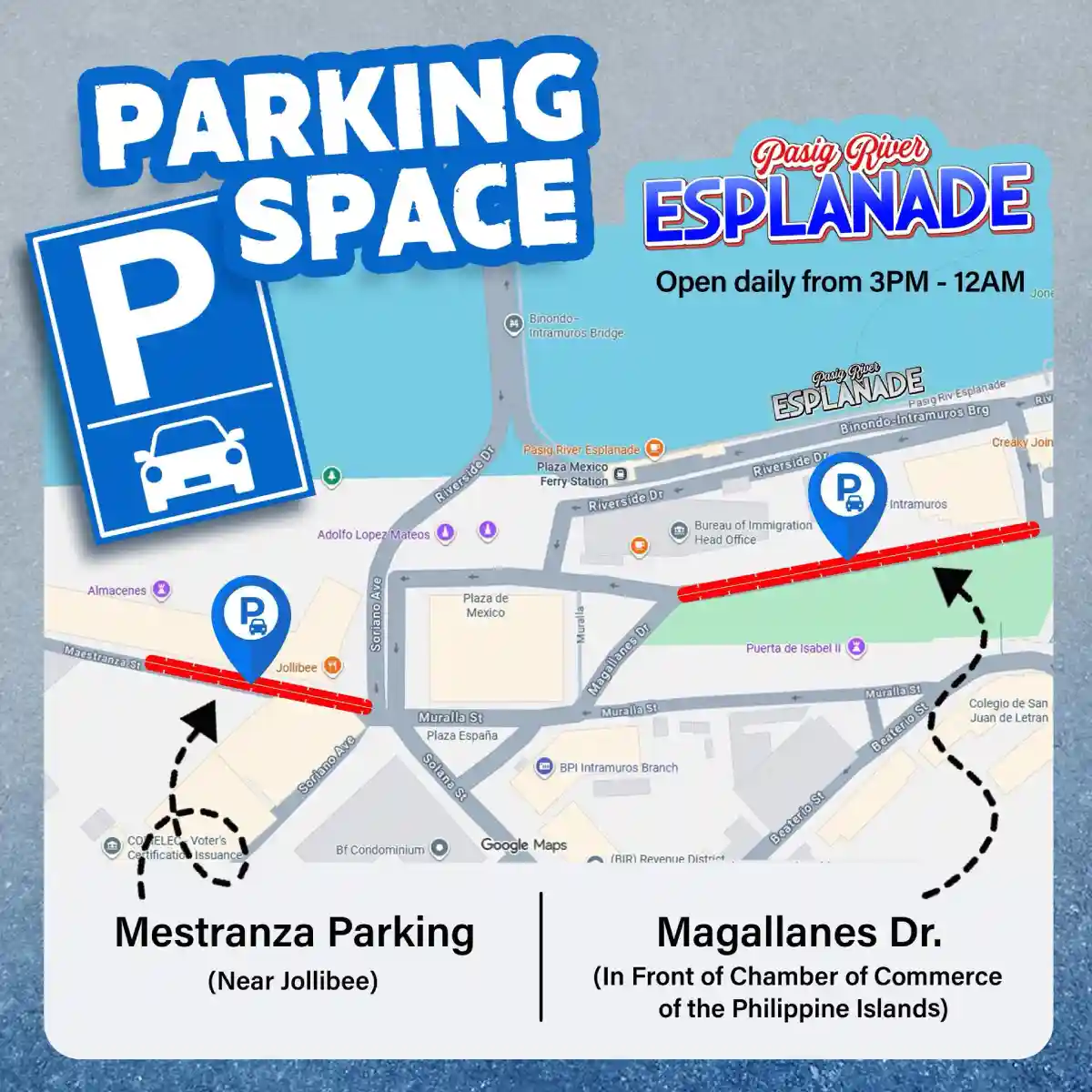
You can also park anywhere in Intramuros and pass through Fort Santiago to get to the far end of the esplanade or at Escolta Car Park if you prefer to park nearer the Binondo side. Check out our Parking Guide to Intramuros for more details.
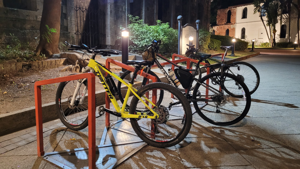
The last time we visited, we didn't see any bike racks along the main esplanade area especially in the Arroceros Forest Park side. You can find bike racks inside Fort Santiago (near the main entrance, near the dungeons and near Papa Kape) but entering requires an additional entrance fee. If you’re biking to the Pasig River Esplanade, I’d recommend giving pedestrians priority and dismounting and wheeling your bikes in the narrower paths where there are many people walking.