If you like going on long drives around the Philippines, you’ve probably seen those yellow-and-white concrete posts with numbers and letters along the roadside. Have you ever stopped and wondered what the numbers mean?
In some countries, these posts are called milestones, though they’re more commonly referred to as kilometer posts in the Philippines and other countries that use the metric system.
Ever heard the old saying “all roads lead to Rome?” This is believed to refer to the Milliarium Aureum (the Golden Milestone), a monument in Rome from which all road distances were measured. During the Roman Empire, markers were put along roads for travelers to know if they were on the right path and how far they were from Rome, and since then, many countries have adapted these for their own roads.
Before the prevalence of GPS and smartphone maps, road markers such as these (along with actual paper maps) helped drivers navigate roads in the Philippines as well. While they may seem outdated now, they still serve a purpose, especially in remote areas where internet signals are weak. These markers may be of interest to those planning to do the Philippine Loop.
What are kilometer posts?
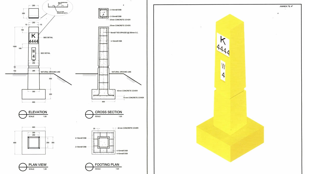
Kilometer posts are small, rectangular concrete posts typically painted yellow and white, installed at fixed intervals (usually every kilometer) along primary and secondary national roads. You'll spot them mostly on both sides of the national highways, particularly in provincial areas.
Each marker has numbers and letters on it. The “KM” or “K” stands for kilometer, and the number tells you how far you are from a designated reference point, commonly known as Kilometer Zero (KM 0).
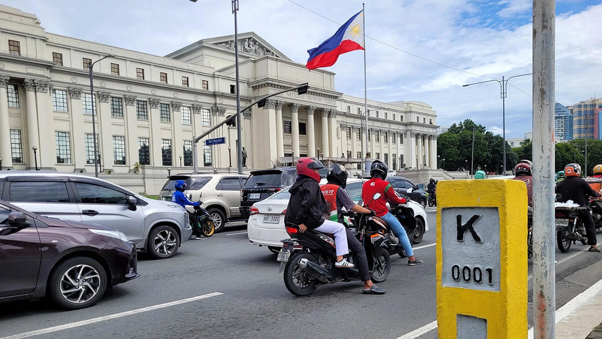
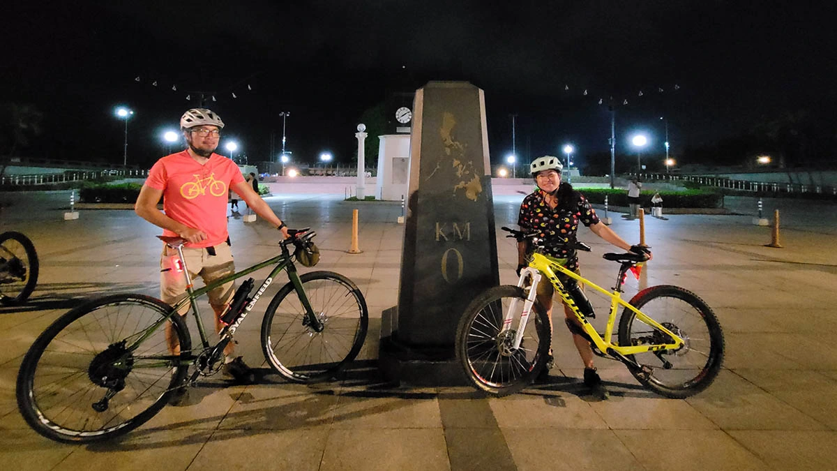
For most roads in Luzon, that reference point is the KM 0 marker at Rizal Park (Luneta) in Manila. Outside Luzon (or depending on which region or island you're in), the reference point can vary. Each major island or province can have its own designated KM 0.
These markers are classified and maintained by the Department of Public Works and Highways (DPWH) and have a uniform design.
How do you read kilometer posts?
Here’s how to decode what the post says:
- KM or K: This indicates “kilometer.”
- The number below ‘KM’ indicates how far you are from the regional or provincial Kilometer Zero. If you're in Luzon and the marker says “KM 100,” you’re roughly 100km from Luneta.
- The letter(s) below: This usually represents the next town or city’s name.
- The small number beside or below that letter: Indicates how far you are from the next town.
So if a post reads “KM 100 ST 35,” you’re:
- 100km from Luneta (assuming you’re in Luzon),
- and 35km away from a town that starts with the letter “ST” (e.g., Sta. Maria in Laguna).
ALSO READ:
First drive: For a tough beast of burden, the Toyota Tamaraw is surprisingly well-mannered
Top Gear PH Podcast Season 2 Episode 13: Nissan, NCAP, and everything in between
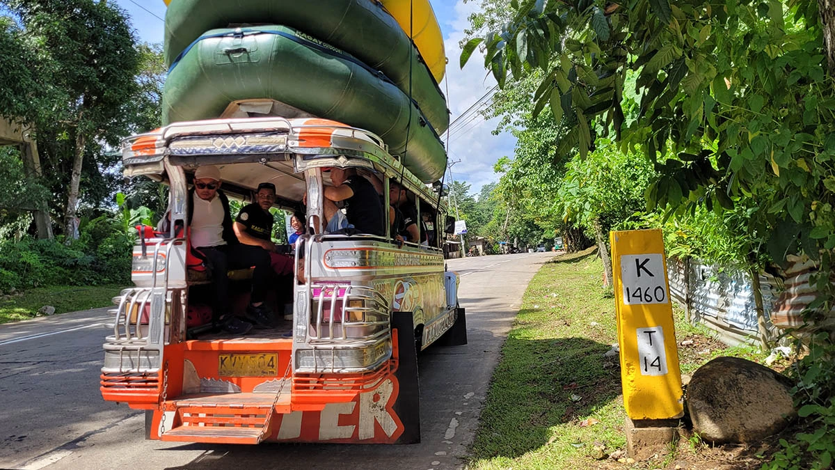
In this photo below, taken somewhere in Northern Mindanao, “K 1460 T 14” means the location is 1,460km from Luneta and 14km away from a town that starts with the letter T.
Here’s another interesting piece of trivia: if the marker is on the right side of the road, you’re driving away from KM 0. If it’s on the left, you’re heading toward the capital or the provincial center.
What purpose do kilometer posts serve?
Although many people rely on apps like Google Maps or Waze today, kilometer posts are still practical, if you get lost in areas with weak mobile signals or during long road trips when your phone battery gives out.
If you’re unfamiliar with the route you’re taking, these markers can help you calculate the distance between places. They indicate how far you are from the capital and the distance to the next town or city, which could help roadtrippers decide if they need to turn back or continue driving forward, especially if they need to gas up or find a place to eat.
For cyclists and riders in particular, kilometer posts can help give a sense of progress and show just how far your journey is. For organized events like bike races, the markers can also help with race management and determining where to put aid or water stations.
Numbered road markers can also be useful for reporting or pinpointing specific points for maintenance engineers and emergency services along a road where there aren’t a lot of establishments, like in the cases of landslides or road crashes.
Where can you find kilometer zero reference points?
In the Philippines, the modern kilometer posts we still see today came about during the completion of the Pan-Philippine Highway (also known as the Maharlika Highway), which connects the country from north to south. Executive Order No. 487 (1977) designated specific locations as official KM 0 points. For Luzon, that’s the Rizal Monument in Luneta.
The order also established that in other islands or provinces: “Km. 0+000 shall be in front of the Provincial Capitol Building in the provincial capital of the province.” That means each province has its own Kilometer Zero, usually located in front of the capitol building. For example:
- Negros Island has KM 0 markers both in Bacolod and Dumaguete.
- Panay Island has its KM 0 in Iloilo.
- Mindoro’s KM 0 can be found in Calapan, Oriental Mindoro.
- Marawi City once served as KM 0 for Mindanao.
But did you know that originally, KM 0 wasn’t in Luneta at all? Before World War II, the main point of reference for distances in the Philippines was the cross atop the Manila Cathedral dome.
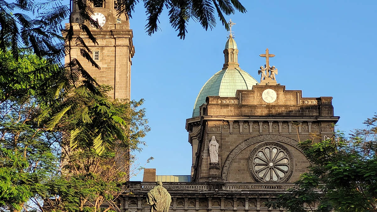
According to various historical accounts cited in news reports and by heritage tour providers, Manila Cathedral served as the original Kilometer Zero for the entire Philippines, before it was moved to its current location in Luneta during the American colonial period as part of the early 20th-century beautification of Bagumbayan (now Rizal Park).
Kilometer zero landmarks around the Philippines
As someone who likes to bike and ride when I travel, I’ve developed a bit of an obsession with hunting down major reference points and have compiled a list of kilometer-zero markers across the different islands and provinces of the Philippines. In case readers are interested, you can check out the exact locations on Google Maps to help you out during long road trips here.
While KM 0 markers may not seem like much to casual tourists, these make good starting points or landmark photo stops along a highway easily accessible to motorcycle riders and bikers, especially those planning to go on epic long rides. While taking photos here during a city ride, we encountered another cyclist who was on his way to bike all the way to Bicol.
Other countries also have zero milestones and KM 0 markers as landmarks along major highways, which could be good landmarks to look out for if you're going on road trips in other countries.
So while navigation apps and GPS make traveling easier today, it never hurts to know the basics. These kilometer markers can still come in handy, especially if you ever get lost, if your GPS runs out of juice, or you find yourself in an offline zone and need to know how far the next town or gas station is.