Buckle up, commuters. Expect more rainy rides in the second half of the year. After the scorching hot and dry weather brought about by El Niño the past few months, La Niña is expected to emerge in the second half of 2024.
According to various forecasts from the Philippine Atmospheric, Geophysical, and Astronomical Services Administration (PAGASA), the weather pattern may begin between June and August 2024 or as late as September to November, bringing heavy rains and flooded streets to make our daily drives even more challenging.
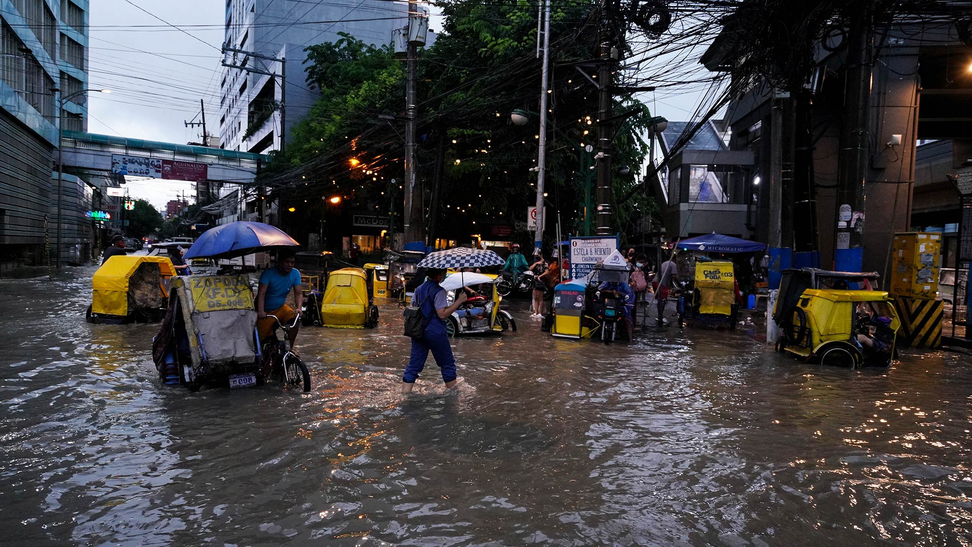
Ahead of the start of the rainy season, the Metropolitan Manila Development Authority (MMDA) identified at least 80 flood-prone areas across Metro Manila that car owners might want to avoid driving through or parking during rush hours and heavy downpours if possible.
This includes Taft Avenue and Espana Boulevard in Manila; G. Araneta Avenue and EDSA Near Camp Aguinaldo in Quezon City; and Maysilo Circle in Mandaluyong.
Other flood-prone areas identified by MMDA in various cities as reported by Manila Standard include the following:
- Malabon City: JP Rizal Street in Barangay Tañong, San Agustin, Gen. Luna Street in Barangay Concepcion-Ibaba
- Navotas City: Naval Street, Barangay Sipac Almacen, Gen. Pascual Street, C-3 Road, and Sampaguita Street in Barangay Tanza Uno
- Caloocan City: Susano Road, Dagat-Dagatan Avenue, Boni Serrano Ave., A. Mabini Street, MacArthur Highway
- Valenzuela City: Santiago Street, MH Del Pilar Street, and Karuhatan Road
- Pasay City: EDSA-Taft Avenue, Roxas Boulevard, and Buendia Avenue
- Makati City: Washington Street, Pasong Tamo, the South Super Highway corner Faraday
- Las Piñas City: Tionquiao Road near Samuel Street and A Canaynay, Real Street from Alabang-Zapote Road going to Casimiro – Kantarilla Creek, and Gatchalian Avenue
- Muntinlupa City: National Road near City Hall, JPA Subdivision
- Parañaque City: West Service Road, Canaynay Road, and Sucat Avenue
A separate Rappler report analyzing the flood-risk areas in Metro Manila noted that Navotas could be the most affected when flooding hits. Roughly two-thirds of Navotas’ land area is expected to be submerged by floods, while half of Malabon, Marikina, and Pasig could also be swamped by rainwater when La Niña hits.
What is being done to reduce floods?
In a press briefing in May, MMDA Acting chairman Romando Artes said his agency was implementing flood mitigation programs in various areas with the help of the Department of Public Works and Highways (DPWH) and local government units.
The measures include continuous regular maintenance activities, flood control projects, and installation of trash traps. Various pumping stations are expected to reduce flooding problems in areas of Manila and Quezon City. The construction of a series of detention ponds was also proposed inside Camp Aguinaldo, Quezon City.
MMDA said it cleaned 199,571 linear meters from January to May 12 this year from continuous regular maintenance activities such as declogging drainage laterals, desilting drainage mains, and dredging waterways.
Artes assured the public that all 71 pumping stations maintained by the MMDA are operational. A total of 163 trash traps were also installed along waterways while 28 others were installed at the pumping stations.
Should pumping stations be insufficient, the MMDA has agreed to open the floodgates of the sewerage treatment plant in Manila Bay as needed to allow floodwaters to flow freely and recede quickly in flooded areas.
Drainage improvement was also undertaken in Caloocan City, which is reportedly the cause of localized flooding in the area. According to the MMDA, the agency regularly conducts the cleanup of drainage, creeks, and other waterways as another flood mitigation measure.
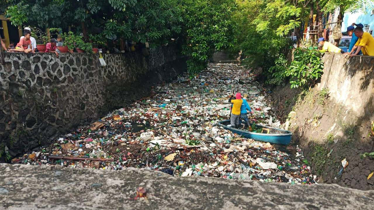
The MMDA has urged the public to conduct proper waste management to minimize garbage and reduce flooding in the metro during the rainy season. According to Artes, trash, such as plastic bags, styrofoam, plastic cups, and leftover food end up clogging canals, drainage systems, and waterways, which prevents rainwaters from flowing freely.
When is it safe to drive through flooded areas?
How do you know if it’s safe to drive your vehicle through a flooded area? The MMDA FLOOD GAUGE indicates water depth, flood measurement in inches, and road accessibility for various cars and other vehicles.
According to the guide, floodwaters that are eight to 10 inches in depth or gutter level to half knee level are still passable to all types of vehicles. When the water depth reaches 13 to 19 inches or knee level or half tire level, a road is classified as not passable to light vehicles.
Meanwhile, floodwaters reaching 26 to 45 inches or from the waist and chest level are considered not passable to all types of vehicles.
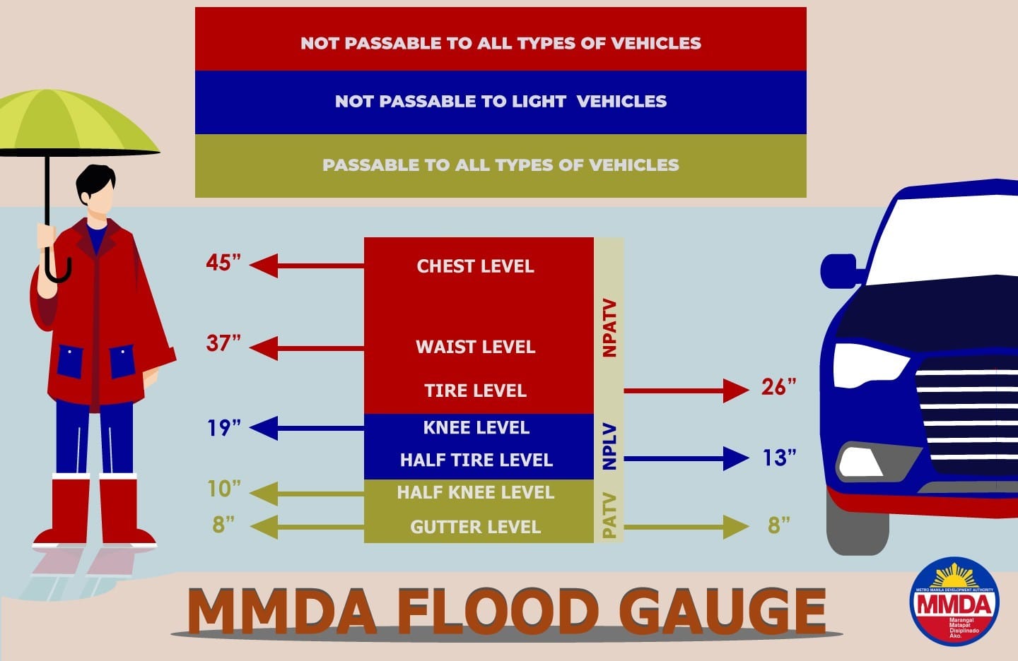
- 8 inches: Gutter deep – Passable to all types of vehicles
- 10 inches: Half-knee deep – Passable to all types of vehicles
- 13 inches: Half tire deep – Not passable to light vehicles
- 19 inches: Knee deep – Not passable to light vehicles
- 26 inches: Tire deep – Not passable to all types of vehicles
- 37 inches: Waist deep – Not passable to all types of vehicles
- 45 inches: Chest deep – Not passable to all types of vehicles
Of course, different models and vehicle classes usually come with different ride heights. SUVs and pickup trucks will obviously have differing capabilities to deal with floods compared to sedans and motorcycles, but it’s better to be safe than sorry. Be sure to follow the guide so you can avoid flood damage and costly repairs to your vehicle.
You can view PAGASA’s flood monitoring and flood maps of Metro Manila and get general flood advisories from NDRRMC online.