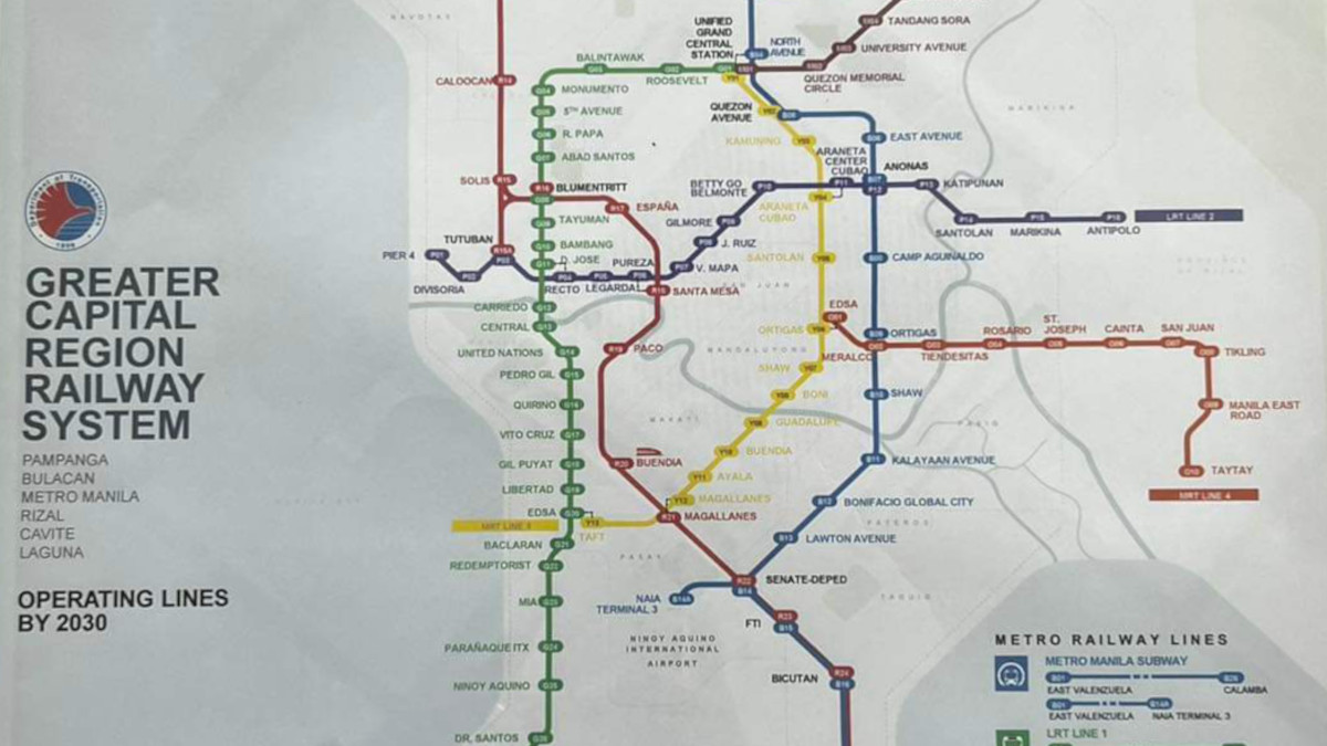
With all the news about all-new, extended, and revived train lines, it might be difficult to keep up with what our upcoming railway system will look like. A map from the Department of Transportation (DOTr) showing the planned operating lines by 2030 might help you out. It includes the Metro Manila Subway, Metro Rail Transit Line 4 and Line 7 (MRT-4 and MRT-7), the North-South Commuter Railway (NSCR), and more.
In this image posted by the Polytechnic University of the Philippines on Facebook, you can see what our train lines are expected to look like by 2030. It was posted after a visit in August by university president Manuel Muhi together with DOTr undersecretary Cesar Chavez and regent Engr. Ronald Laurel to discuss the school’s railway engineering internship program.
Greater Capital Region 2030 railway system map

As of writing, the operational railways in the capital region are the MRT-3 (yellow), the Light Rail Transit Line 1 (LRT-1, green), and the LRT-2 (violet), for a grand total of three lines serving the urban population and those coming in and out of Mega Manila. We can’t not mention the limited operations of the PNR, of course, as they work on revitalizing the North-South Commuter Railway (NSCR).
OTHER STORIES YOU MIGHT HAVE MISSED:
Manny Villar is looking to take over and extend a portion of the LRT-1 Cavite Extension
All Metro Manila Subway, NSCR, and MRT-4 stations will have platform screen doors
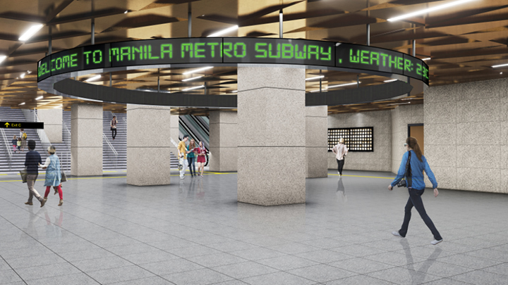
Metro Manila Subway
The massive subway project will span from East Valenzuela to Bicutan and will have 15 stations, including a spur line to Ninoy Aquino International Airport Terminal 3.
As of July, the DOTr said that the subway is targeted to be fully operational by 2029. The train line is meant to cut the 1.5-hour travel time between NAIA and Valenzuela to just 41 minutes, and is expected to serve around 519,000 riders daily.
ALSO READ:
A student’s guide to the LRT-1, LRT-2, and MRT-3 train lines
Pangilinan-led Metro Pacific looking to take over MRT-3 ops, set up cable car systems
MRT-4 and MRT-7
The MRT-4 will stretch from EDSA’s midpoint in Ortigas to the east in Taytay, Rizal. There are 10 planned stations, cutting travel time between the two terminals from 1.5 hours to just 27 minutes. It will serve around 400,000 passengers daily. The DOTr signed a contract with Ricardo Rail Australia, the eventual shadow operator, on March 30, with a target for full operations by 2028.
Meanwhile, the MRT-7 will connect San Jose Del Monte, Bulacan, and the Unified Grand Central Station with 14 stations. It is expected to be complete by June 2025.
NSCR
Another big-ticket project is the NSCR, which aims to revitalize and add new stops to the old La Union–Bicol train line. According to the map, the NSCR train line will connect Clark and Calamba by 2030, with a South Long Haul line going from Sucat all the way to Daraga, Albay. There will also be a Clark Airport Express that connects Alabang through Buendia to the airport terminal, and a Blumentritt Shuttle that connects to the historic Tutuban station.
NOTE: This article first appeared on Spot.ph. Minor edits have been made.